| Other
Transportation Information Car Rentals
Limousine Rentals
Taxi &
Shuttle Service
Boat / Watercraft
Rentals
Other Accommodations:
Lodging
Dining |
| COMMERCIAL
AIRPORTS: |
| Austin-Bergstrom International Airport |
| Located in Austin,
Texas, approximately 55 miles from the Lakes and Hills region. Driving Directions: From the airport exit, turn left on
Highway 71. Follow the signs for Llano / Johnson City. Drive approximately 45
miles |
| San Antonio International Airport |
| Located in San Antonio,
Texas, approximately 90 miles from the Lakes and Hills region. Driving Directions: From the airport via 410 Loop West -
Approximately one and one-half (1 ½) miles on Loop 410 and you will pick up Route 281
North (Johnson City). Take 281 North toward Marble Falls (approximately 90 miles).
|
| LOCAL
PRIVATE AIRPORTS: |
| Burnet
Municipal Airport |
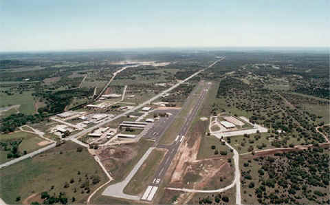 |
"Kate Craddock Field" is located approximately one mile south of Burnet
on Hwy 281.
5,000 foot lighted
runway with a full length taxiway, up to 34,000 pounds per wheel.
Two instrument
approaches.
Avgas and jet fuel
available.
No landing fee,
parking fee or tie down fee.
Space available for
56 tie downs on paved parking. T-hangars available for a fee.
For current
info on this airport:
(512) 756-6093
AirNav.com
|
|
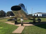 Burnet Airport is home of the Highland Lakes Air Museum Burnet Airport is home of the Highland Lakes Air MuseumOperated by the Highland Lakes Squadron of the Commemorative
Air Force. Static displays of numerous WWII (and later) aircraft and military
vehicles, and wartime memorabilia. Open weekends. Admission: Adults $3, Seniors $2,
Children $1 - 512-756-2226
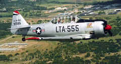 Come see the annual Airshow and the aerial
displays during Bluebonnet Festival! Come see the annual Airshow and the aerial
displays during Bluebonnet Festival!
|
|
| Horseshoe
Bay Airport |
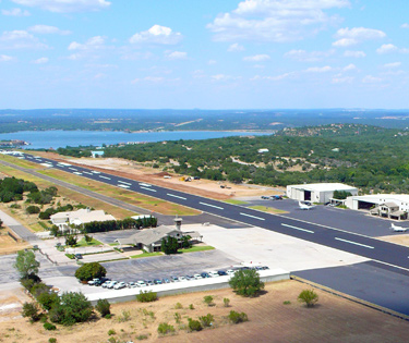 |
Located inside Horseshoe Bay Resort, 5 miles west
of Hwy 71 on Clayton Nolen Drive off of RR 2147.
6,000-foot lighted runway can
accommodate aircraft up to DC-9 jets.
Terminal building housing luxury
lounge, pilot ready room, fueling services and resort transportation.
There are fees for landing, parking
tie-down and hangering.
WATCH FOR DEER ON RUNWAY
For current info on this
airport:
(830) 598-6386
or
(830) 598-7798
AirNav.com
|
|
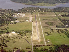
| Spicewood
Airport |
For current info on this airport:
830-693-7707
512-789-1221
AirNav.com |
Located in Spicewood at
the end of Paleface Ranch Road east of Hwy 71.
- 3900' X 30'
- 100LL Self Serve BP and AOPA
- UNICOM: 122.8
- No jet traffic
- No night-time operations
- Watch for deer on runway
- No touch 'n go's or Stop and Go's
- Call ahead for a crew car or overnight rentals
|
|
|