LAKES AND HILLS
HISTORIC SITES
Llano County
Castell
Area
Llano
Area
Other Areas
Burnet County
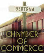
Bertram Area
Burnet Area
Horseshoe
Bay Area
Kingsland
Marble Falls Area
Smithwick
Area
Spicewood
Area
Other Areas

|
| Historic Landmarks |
| Information provided by Texas Historical
Commission. Items without information are no longer included in the state's
database. |
| Bertram Lumber Company
Store |
 |
| Bertram Lumber Company
Warehouse |
|
| Bertram School Location: from the intersection of sh 29 and Fm 243 in
Bertram take FM 243 NE .5 mi.
When Bertram was founded in 1882 along the Austin
& Northwestern Railroad, one of the first structures erected was a combination school,
Sunday School, and Masonic Lodge hall. Rudolph Bertram, Austin Railroad executive for whom
the town was named, contributed $50 for construction of the school. The frame building was
enlarged as the community grew. By 1908, however, new facilities were needed for the 264
students. In May 1909, Bertram voters approved incorporation as an independent school
district and construction of a new school building. This 2-story red brick structure was
erected on property purchased from T. D. Vaughn. Designed by architect George Endress and
built by contractor M. L. Langford, it opened in the fall of 1909 with J. N. Matthews as
the first principal. Bertram was then in the midst of a cotton-growing boom, and students
often missed the beginning of school to help in the fields. As the enrollment increased,
sports and other extracurricular activities were introduced. a separate high school was
erected in 1925 and a gymnasium in 1948. Over a period of years, several smaller county
schools transferred their students to Bertram. In 1970 Bertram schools merged with the
Burnet district. |
|
| Black's Fort Location: 8 mi. N on FM 1174, then 1 mi. E on CR 210A.
Marker reported toppled Nov. 2006.
Built as a defense against the Indians in 1851 by
William Black (1815-1907) on land owned by him. In the stockade, constructed of cedar
logs, sentries were kept on guard on moonlight nights. Guns and ammunition for public use
were kept here. Abandoned in 1868. |
|
| Bryson Place Location: On private property.
John H. Bryson (1850-1930) and his wife Milda
(Barton) (1852-1952) had this home constructed on their land in 1906 by local builder
Marcus Langford. It is located on a site purchased in 1855 by Milda's uncle Welborn Barton
and later owned by her father Decator Barton. The Bartons and Brysons had been neighbors
in South Carolina before migrating to Texas. Descendants of these pioneer Burnet County
families have retained ownership of the turn-of-the-century residence. Recorded Texas
Historic Landmark - 1982 |
|
| Chris Dorbant House |
|
| Joppa Community Location: from Bertram take FM 243 NE approx. 2 mi., then
north on CR 272 for 6 miles
Some of the first settlers in this farming and
ranching community were the William Alexander Faires family in 1874 and the Martin Luther
Ater family the next year. The settlement was called "Pool Branch" for a nearby
pool formed by a waterfall. In the 1880s a cotton gin and mill were located on the pool
which was known as "Mill Pond". There was a store, a blacksmith shop, and one
mile from the gin, Mrs. Hattie Snow Smith ran a hat shop in her home. J. S. and Jane
Danford of Delaware County, Iowa, gave two acres in 1881 for a school and church, provided
the schoolhouse was completed by March 1, 1882. Area residents met the deadline. With the
establishment of a post office in 1891, the community's name changed to the biblical,
"Joppa". William F. Childers served as the first postmaster. After the coming of
rural mail delivery, the post office closed in 1904. Worship was held in the Joppa
Schoolhouse until 1913 when the Joppa Baptist Church congregation erected this
meetinghouse. The Joppa School consolidated with Bertram in 1942. All that remains of the
pioneer settlement is the church house and school building which serves as a community
center. |
|
| Joppa Iron
Bridge-N-Gabriel - Bertram |
|
| Lockett-Reed Building |
|
| Mahomet Cemetery Location: from Bertram take FM 243 NE approx. 10 miles, then
SE on Cemetery Rd. approx. .3 mile
This cemetery, with interments dating back to the
1850s, became a community graveyard for the Sycamore Springs and Mahomet rural
communities. In 1909 J. W. Williams and J. W. and Nellie Greer deeded the cemetery
property to the community of Mahomet. Among the hundreds of people buried here are many of
the area's pioneer settlers and their descendants and veterans of wars ranging from the
Mexican War (1846-1848) to the Vietnam War. Mahomet Cemetery remains active and is
maintained by an association of descendants of people buried here. Sesquicentennial of
Texas Statehood 1845 - 1995 |
|
| Mahomet-Sycamore Springs
Community Location: from Bertram
take FM 243 NE approx. 6 miles to ROW
Settlement in this part of Burnet County began in
the 1850s. Two early communities were Mahomet and Sycamore Springs, originally located 8
miles from each other. Pioneers of Mahomet were George Ater, William G. Hall, and Mr.
Sanford, while Sycamore Springs was settled by the Smart, Stewart, and Williams families.
Although Sycamore Springs once had 3 gins, a general store, a school, and 2 churches,
little evidence of the community now remains. Much speculation has taken place over the
years concerning the origin of the unusual name of the Mahomet settlement. Research now
indicates that the town was probably named by first postmaster George Ater, who came to
Texas from Mahomet, Illinois. both the original Mahomet Post Office and an Austin-Lampasas
Stage stop were located at his home. The Mahomet Christian Church, moved from Sycamore
Springs in 1899, continues to worship near this site. Mahomet is also the home of the Mt.
Horeb Masonic Lodge, which was relocated from nearby Williamson County in 1915. The
community burial ground (.5 mi. SW dates from the early 1850s. The history of these two
related settlements is an important part of Burnet County's heritage. |
|
| Middle Gabriel Iron Bridge |
|
| Mount Horeb Lodge Location: from Briggs, 4 mi. SE on US 183, then 3 mi. SW on
FM 243
Chartered Jan. 21, 1854; met in log schoolhouse.
Erected own lodge hall 1856 on land given by Grand Master Sam Mather and B. K. Stewart.
First floor used as church and school. A fire in 1915 razed hall. Lodge rebuilt here 1916
on land given by G. T. and W. J. Williams. (1967) |
|
| Mount Zion Cemetery Location: from Bertram take FM 243 SW approx. 3.4
miles to CR 330, then east on CR 330 .6 mi. to CR 330A; then north on CR 330A .5 mi. to
cemetery
John Jennings (1802-1867), his wife Sarah C.
(Sally) (1806-1879), and their family came to this area in 1851. The settlement which grew
up around their farm became known as Jennings Creek community. After Burnet County was
created in 1852, John Jennings was instrumental in organizing the new county government.
He was a county commissioner for four years. The oldest documented burial in this
graveyard, which was originally known as the Jennings Family Cemetery, is that of Mary Ann
Jennings (1835-1856). Other early burials include those of John and Sally Jennings,
members of their family, and neighbors. The Jennings Family Cemetery became known as Mount
Zion Cemetery when the Mount Zion Cumberland Presbyterian Church was built about one-half
mile south of this site in the 1890s. The land on which the cemetery is situated remained
in the Jennings family until 1944. Among the more than five hundred grave markers here are
tombstones of veterans of the Civil War and the Spanish American War. A cemetery
association incorporated in 1972 cares for the historic graveyard. |
|
| Oatmeal Cemetery - Oatmeal Location: from Bertram take FM 243 SW approx. 5.2 mi.,
then east on CR 326 approx .3 mi., then south on CR 327 approx. .7 mi. to cemetery
Some of the earliest pioneers of the Oatmeal
community are interred in this cemetery. The oldest documented burials are those of Mary
Smith and her year-old daughter, Fanny, both of whom died on September 16, 1854. Mr. and
Mrs. J. L. Roundtree deeded the two acres of land containing the cemetery in 1871. Among
those interred here are veterans of the Civil War, World War I, and World War II. An
additional land acquisition in 1983 enlarged the cemetery to three acres. A cemetery
association formed in 1945 maintains the historic graveyard. |
|
| Oatmeal School - Oatmeal Location: from Bertram take FM 1174 S approx. .5 mi.
to CR 326; west on CR 326 approx. 1.5 mi. to CR 327; south on CR 327 .5 mi.
This building, once a combined school and church,
was erected in 1869 in Oatmeal, second oldest community in Burnet County. The settlement,
founded in 1849, had a post office from 1853 to 1876. This limestone structure was
successor to the first school of 1858. Excepting minor repairs and addition of a board
floor, building looks much as it did in 1869. It is a church today. A third school, built
in 1924, now houses a community center. Recorded Texas Historic Landmark - 1968 |
|
| Prairie Point Community,
Site of Location: from Bertram
take FM 243 N approx. 5 mi. to CR 274, then east on CR 274 approx. 2 miles to intersection
with CR 280
Anglo settlement of this part of Burnet County
began in the 1850s. By the 1870s settlers had established cattle and sheep ranches as well
as a number of family farms. A community school opened in 1882 and remained in operation
until 1921. The Prairie Point Missionary Baptist Church was organized in 1883 and met in
the schoolhouse until it burned in 1890. The congregation worshipped in a brush arbor
until a new school was erected, then met at the school until 1906, when a new sanctuary
was built. The church eventually was disbanded in 1957. |
|
| Ray House |
|
| Reed Building |
|
| Shady Grove Community Location: from Bertram take FM 1174 N approx. 5 mi. to
CR 200, then west 200 yds.
In the 1850s and 60s families settled on this farm
and ranch land along the Middle Gabriel river. The Old Austin-Lampasas and Burnet-Belton
roads intersected here. Six acres deeded by Alexander M. Barton in 1877 later became the
site of a schoolhouse, church and cemetery. At first the community was called
"Russell Gabriel". The Cumberland Presbyterian Church organized and met in the
school building in 1878. Soon the name changed to "Grove" because the
schoolhouse was located in a grove of live oak trees. The settlement boasted a cotton gin
and corn mill, a general store and blacksmith shop, a doctor and a Masonic Lodge. In 1882
the Presbyterian, Methodist and Baptist congregations built a Union Arbor for camp
meetings and revivals. For a few months in 1902 there was a post office. Since there was
another Shady Grove in Texas, the name "Tamega" was used. A general store by
that name operated here for 50 years. The Presbyterian fellowship erected this church
structure first and then in 1905 built this tabernacle. The school consolidated with
Bertram in 1942. When the Presbyterian congregation merged with Bertram in 1966, this
property became a community center and homecoming site. |
|
| South Gabriel, Village of Location: from Bertram take FM 1174 S approx. .5 mi.,
then east on CR 322 approx. .3 miles
The South Gabriel Post Office opened in Postmaster
Thomas Lewiston's mercantile store on Sept. 29, 1871. The village, named for the South San
Gabriel River, was also called Lewiston. Located on the Austin-Burnet Road, the hamlet
soon had two stores, a hotel, saloon, cotton gin, school, church, and wagon, saddle,
blacksmith, and carpentry shops. The population in 1880 was 39. The Austin and
Northwestern Railroad passed to the north of the settlement in 1882, and on Dec. 8, 1882,
the post office moved to the new town of Bertram (2 miles N) and South Gabriel
disappeared. |
|
| Stewart Pioneer Home Location: off FM 243
Benjamin Hansford Stewart (d. 1932), a native of
Tennessee, came to Texas in 1851. A farmer and rancher, he also served as Burnet County
sheriff, 1874-75. He constructed this frame house in 1905 as a residence for his son Homer
and daughter-in-law Viola. The Texas style home, similar to other area ranch houses of the
early 1900s, features a chimney of hand-hewn limestone. Six generations of the B. H.
Stewart family have owned and used the home. Recorded Texas Historic Landmark - 1980 |
|
|


|