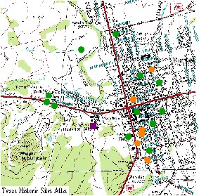
BURNET HISTORIC SITES - BURNET COUNTY, TEXAS

TEXAS HISTORIC SITES

Llano County

Castell Area

Llano Area

Other Areas

Burnet County

Bertram Area

Burnet Area

Horseshoe Bay Area

Kingsland

Marble Falls Area

Smithwick Area

Spicewood Area

Other Areas


City of Burnet Texas Historic Sites

Information from the Texas Historical Commission

Landmark Data and Maps Photos
3 Log Cribs Survey form Photo

General Adam R. Johnson House & Barn (Airy Mount)

Survey form
Historical marker
Location map
Photo
Adam R. Johnson House Survey form
Location map
Photo
Airy Mount Barn Historical marker
Location map
Badger Building Historical marker
Location map

Bethel Cemetery

Historical marker
Location map

Burnet Bulletin

Historical marker
Location map

Burnet County - Burnet

Historical marker

Burnet County Courthouse

National Register listing
Historic Courthouse
Burnet County Jail Survey form
Historical marker
Location map
Photo

Camberland House

Survey form
Location map
Photo

Christain-Craddock House

Survey form

Cook Home

Historical marker
Location map
Photo

Fort Croghan Buildings

Survey form
Historical marker
Location map
Photo
Fort Croghan Museum and Grounds Museum information
Location map
Fort Croghan Site Historical marker
Location map

Galloway House

Survey form
Historical marker
Location map

Holland Springs

Historical marker
Location map

Hoover's Valley Cemetery

Historical marker
Location map
Hullum-( Humphrie) Home Survey form

Kerr, Peter

Historical marker
Location map

Lake Victor Lodge No. 1011, A. F. & A. M.

Historical marker

Logan Vandeveer Bldg.

Survey form
Location map
Photo

Longhorn Cavern Administration Building

Survey form
Historical marker
Location map
Longhorn Caverns Historical marker
Location map

Magill Family Cemetery

Historical marker

Moore-Kinser House

Survey form Photo

NR Survey Structure

Survey form

Old Cook House

Survey form
Location map

Oldest Commercial Building in Burnet

Historical marker
Location map
One-Story Frame House Survey form
Location map
Photo

Pierce Green House

Survey form

Rocky Rest

Historical marker
Location map

Russell-McFarland Homestead

Historical marker
Location map

Russell House

Survey form
Location map
Schnabel House Survey form
Location map
Photo

Seidens Ticker's

Survey form

Stickling, Site of Town of

Historical marker
Location map

Thomas Ranch House

Survey form
Historical marker
Location map
Photo

Vandeveer, Logan

Historical marker
Location map
Whitaker, George, Home Survey form
Historical marker
Location map
Photo
Wolf, Jacob, Mr. and Mrs. Historical marker
Location map

Burnet Chamber of Commerce

HOME

CONTACT US

(c) 2003 Copyright by:
Hill Country Economic Development Council

Revised April 08, 2004
Visitors to Lake and Hills

Website Architecture, Hosting and Maintenance
Donated by
MegaIQ Website Architects, Horseshoe Bay, Texas.

Visit MegaIQ Website Architects